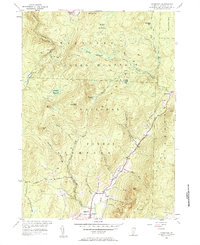
1954 Map of Stamford
USGS Topo · Published 1984About this map
Green Mountain National Forest dominates this mid-century landscape, where the high ridges of the southern Green Mountains dictate the flow of the Hoosic River and its numerous tributaries. The village of Stamford sits in the valley at the southern edge of the sheet, connected to the northern reaches by an old Stage Road that winds through the mountainous terrain. In this era, the high-altitude wetlands such as Stamford Meadows and Beaver Meadows remained undeveloped, punctuated only by small seasonal clearings like Camp Meadows and Camp Casino. The topography is defined by significant peaks including Houghton Mountain and Prospect Mtn, while the drainage basins for the West Branch Deerfield River and the North Branch Hoosic River carve deep valleys through the forest. Local history is anchored by the Houghton Cem and the small settlement of Heartwellville at the junction of several mountain streams.
Find a feature on this map
49 named features on this map. Tap any name to fly to it.
Don’t see what you’re looking for? This feature index may not catch every label — zoom into the map to look around manually.
Map Details
Editions of this 1954 Stamford Map
Other maps of this area

1886 · Greylock
USGS Topo · 1:62,500

1886 · Hawley
USGS Topo · 1:62,500

1889 · Wilmington
USGS Topo · 1:62,500

1890 · Hawley
USGS Topo · 1:62,500

1891 · Wilmington
USGS Topo · 1:62,500

1891 · Greylock
USGS Topo · 1:62,500

1893 · Greylock
USGS Topo · 1:62,500

1894 · Hawley
USGS Topo · 1:62,500

1898 · Bennington
USGS Topo · 1:62,500

1898 · Greylock
USGS Topo · 1:62,500