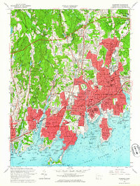
1960 Map of Stamford
USGS Topo · Published 1964About this map
Stamford and Greenwich dominate this coastal survey, showcasing a landscape transitioning from suburban density to wooded upland estates at the start of the 1960s. The bustling corridor between the New York New Haven And Hartford railroad and the Connecticut Turnpike contrasts with the northern reaches of Stanwich and Hunting Ridge, where landmarks like Webbs Hill and Altschul Pond define the interior. The map documents a high concentration of institutional landmarks, from the Stamford Hospital and Heliport to numerous historic burial sites, including the Old Burying Ground and Agudath Sholom Cem. Along the shore, the jagged coastline is marked by Shippan Point and Greenwich Point Park, which shelter the waters of Stamford Harbor and Cos Cob Harbor. This era represents a period of significant regional infrastructure, as seen in the interchanges of the Merritt Parkway and the expansion of residential neighborhoods like Glenbrook, Springdale, and Riverside.
Find a feature on this map
140 named features on this map. Tap any name to fly to it.
Don’t see what you’re looking for? This feature index may not catch every label — zoom into the map to look around manually.
Map Details
Editions of this 1960 Stamford Map
2 editions found
Other maps of this area

1892 · Stamford
USGS Topo · 1:62,500

1892 · Norwalk
USGS Topo · 1:62,500

1893 · Stamford
USGS Topo · 1:62,500

1893 · Norwalk
USGS Topo · 1:62,500

1897 · Oyster Bay
USGS Topo · 1:62,500

1898 · Oyster Bay
USGS Topo · 1:62,500

1899 · Stamford
USGS Topo · 1:62,500

1900 · Oyster Bay
USGS Topo · 1:62,500

1901 · Northport
USGS Topo · 1:62,500

1903 · Northport
USGS Topo · 1:62,500