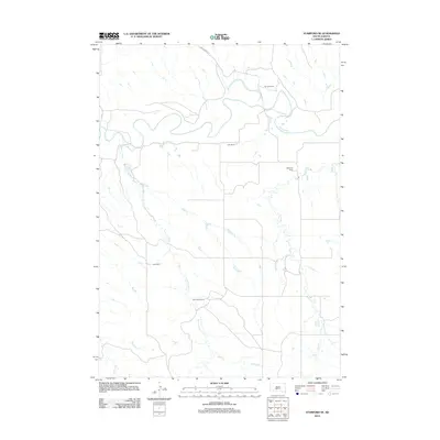
2012 Map of Stamford SE
USGS Topo · Published 2012About this map
The White River meanders across this rural section of Mellette County, South Dakota, defining the northern landscape where several family-named ranching operations are established. These holdings, including Perault Ranch, Vohr Ranch, and Hathaway Ranch, occupy a terrain shaped by a series of tributary drainages. Water sources are critical in this prairie environment, marked by the presence of White Horse Springs and seasonal flows such as Runs Close Cr and Yukmi Cr. The map reveals a sparsely populated area where large land tracts predominate, with Cnty Road Ch 1 providing the primary transportation corridor through the northern bluffs above the river valley. Further south, the Iwan Ranch and Bear Heels Ranch illustrate the continued importance of livestock and agriculture in the Swift Bear Segment.
Find a feature on this map
11 named features on this map. Tap any name to fly to it.
Don’t see what you’re looking for? This feature index may not catch every label — zoom into the map to look around manually.
Map Details
Editions of this 2012 Stamford SE Map
This is the sole edition of this map. No revisions or reprints were ever made.
Other maps of this area

1951 · Stamford SW
USGS Topo · 1:24,000

1951 · Stamford SE
USGS Topo · 1:24,000

1951 · Cedar Butte NW
USGS Topo · 1:24,000

1951 · Cedar Butte NE
USGS Topo · 1:24,000

1951 · Okaton SW
USGS Topo · 1:24,000

1951 · Murdo 3 NW
USGS Topo · 1:24,000

1955 · Martin
USGS Topo · 1:250,000

1958 · Martin
USGS Topo · 1:250,000

1972 · Okaton
USGS Topo · 1:24,000

1972 · Stamford NW
USGS Topo · 1:24,000