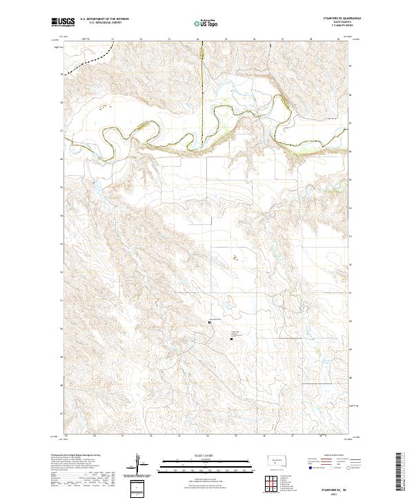
2021 Map of Stamford SE
USGS Topo · Published 2021About this map
The White River meanders across the northern portion of this South Dakota landscape, defining the jagged boundaries where Jackson, Jones, and Mellette counties meet. This section of the river is characterized by complex oxbows and a network of ephemeral drainages including Runs Close Cr and Yukni Cr that cut through the surrounding high ground. The map captures a quiet, rural stretch of the plains where evidence of early 20th-century settlement remains in the form of secluded burial grounds. Notable landmarks include the Saint Paul German Lutheran Cem, located near the center of the sheet, and the Good Road Cem further north. In the southeastern corner, the presence of White Horse Springs indicates a vital water source in this dry environment, while Lauvie Cr drains the southwestern quadrant, illustrating the delicate hydrology of the West River region.
Find a feature on this map
17 named features on this map. Tap any name to fly to it.
Don’t see what you’re looking for? This feature index may not catch every label — zoom into the map to look around manually.
Map Details
Editions of this 2021 Stamford SE Map
This is the sole edition of this map. No revisions or reprints were ever made.
Other maps of this area

1951 · Stamford SW
USGS Topo · 1:24,000

1951 · Stamford SE
USGS Topo · 1:24,000

1951 · Cedar Butte NW
USGS Topo · 1:24,000

1951 · Cedar Butte NE
USGS Topo · 1:24,000

1951 · Okaton SW
USGS Topo · 1:24,000

1951 · Murdo 3 NW
USGS Topo · 1:24,000

1955 · Martin
USGS Topo · 1:250,000

1958 · Martin
USGS Topo · 1:250,000

1972 · Okaton
USGS Topo · 1:24,000

1972 · Stamford NW
USGS Topo · 1:24,000