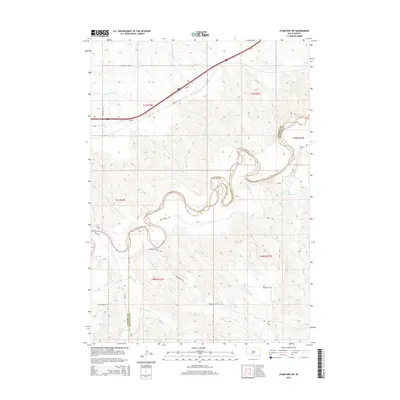
2015 Map of Stamford SW
USGS Topo · Published 2015About this map
The White River winds through this South Dakota landscape, defining the jagged border between Jackson and Mellette counties. This 2015 survey reveals a terrain shaped by water and name-bearing roads that hint at the local heritage and ranching history of the region. Local travel is facilitated by a network of rural routes including Brave Bull Rd and Perault Rd in the north, while Horseshoe Butte Rd and Iron Heart Rd traverse the southern reaches near the drainages of Black Pipe Cr and Porcupine Cr. Modern infrastructure like SD-248 and SD-63 bisects the prairie, providing a contrast to the natural curves of Larvie Cr and Brave Bull Cr. The township and range lines overlaying the river's deep meanders illustrate the systematic partitioning of this western landscape.
Find a feature on this map
22 named features on this map. Tap any name to fly to it.
Don’t see what you’re looking for? This feature index may not catch every label — zoom into the map to look around manually.
Map Details
Editions of this 2015 Stamford SW Map
This is the sole edition of this map. No revisions or reprints were ever made.
Other maps of this area

1951 · Stamford SW
USGS Topo · 1:24,000

1951 · Belvidere
USGS Topo · 1:24,000

1951 · Stamford SE
USGS Topo · 1:24,000

1951 · Cedar Butte NW
USGS Topo · 1:24,000

1951 · Cedar Butte NE
USGS Topo · 1:24,000

1951 · Pass Creek NE
USGS Topo · 1:24,000

1953 · Belvidere NE
USGS Topo · 1:24,000

1955 · Martin
USGS Topo · 1:250,000

1958 · Martin
USGS Topo · 1:250,000

1972 · Stamford NW
USGS Topo · 1:24,000