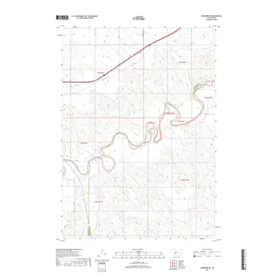
2017 Map of Stamford SW
USGS Topo · Published 2017About this map
The White River winds through the heart of this South Dakota landscape, defining a complex system of drainage and relief along the Jackson Co Mellette Co boundary. The topography is shaped by numerous tributaries, including Brave Bull Cr and Black Pipe Cr to the north and west, while Larvie Cr and Porcupine Cr cut through the southern reaches of the quadrangle. This 2017 survey reflects the modern infrastructure of the region, where Hwy 16 serves as the primary corridor of travel, crossing the northern plains above the river's deep meanders. The map provides a detailed view of the township and range divisions, showing the intricate relationship between the natural waterways and the geometric legal boundaries of the Great Plains.
Find a feature on this map
14 named features on this map. Tap any name to fly to it.
Don’t see what you’re looking for? This feature index may not catch every label — zoom into the map to look around manually.
Map Details
Editions of this 2017 Stamford SW Map
This is the sole edition of this map. No revisions or reprints were ever made.
Other maps of this area

1951 · Stamford SW
USGS Topo · 1:24,000

1951 · Belvidere
USGS Topo · 1:24,000

1951 · Stamford SE
USGS Topo · 1:24,000

1951 · Cedar Butte NW
USGS Topo · 1:24,000

1951 · Cedar Butte NE
USGS Topo · 1:24,000

1951 · Pass Creek NE
USGS Topo · 1:24,000

1953 · Belvidere NE
USGS Topo · 1:24,000

1955 · Martin
USGS Topo · 1:250,000

1958 · Martin
USGS Topo · 1:250,000

1972 · Stamford NW
USGS Topo · 1:24,000