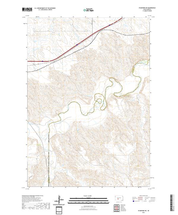
2021 Map of Stamford SW
USGS Topo · Published 2021About this map
The White River winds in a tight, meandering pattern across this Jackson and Mellette County landscape, defining the transition between the rolling uplands and the river valley. This drainage network is fed by several prominent tributaries, including Brave Bull Cr and Black Pipe Cr in the western reaches, and Porcupine Cr and Larvie Cr to the south and east. The rugged topography is bisected by major transportation corridors, with Interstate 90 and Highway 248 cutting through the northern sections, while Brave Bull Rd provides local access. The map reveals the intricate natural drainage system characteristic of the South Dakota plains, where the White River has carved a distinct path through the township and range divisions of the region.
Find a feature on this map
17 named features on this map. Tap any name to fly to it.
Don’t see what you’re looking for? This feature index may not catch every label — zoom into the map to look around manually.
Map Details
Editions of this 2021 Stamford SW Map
This is the sole edition of this map. No revisions or reprints were ever made.
Other maps of this area

1951 · Stamford SW
USGS Topo · 1:24,000

1951 · Belvidere
USGS Topo · 1:24,000

1951 · Stamford SE
USGS Topo · 1:24,000

1951 · Cedar Butte NW
USGS Topo · 1:24,000

1951 · Cedar Butte NE
USGS Topo · 1:24,000

1951 · Pass Creek NE
USGS Topo · 1:24,000

1953 · Belvidere NE
USGS Topo · 1:24,000

1955 · Martin
USGS Topo · 1:250,000

1958 · Martin
USGS Topo · 1:250,000

1972 · Stamford NW
USGS Topo · 1:24,000