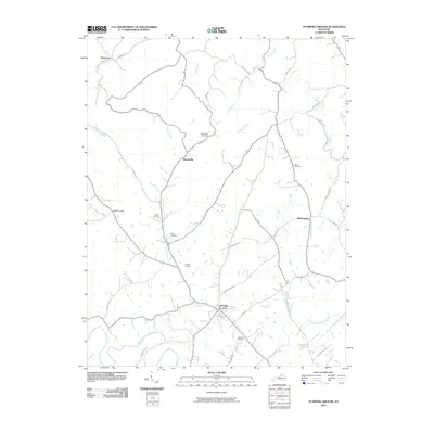
2010 Map of Stamping Ground
USGS Topo · Published 2010About this map
Stamping Ground sits as the primary hub in this portion of Scott County, where the landscape is defined by the branching tributaries of the Kentucky River watershed. The terrain is deeply carved by watercourses like Locust Fork and McConnell Run, which dictated the early settlement patterns and the winding routes of local roads such as Stonetown Rd and Sebree Rd. Small hamlets like Skinnersburg and Minorsville appear as quiet junctions, each maintaining its own identity through local landmarks and small family or community burying grounds.
Find a feature on this map
47 named features on this map. Tap any name to fly to it.
Don’t see what you’re looking for? This feature index may not catch every label — zoom into the map to look around manually.
Map Details
Editions of this 2010 Stamping Ground Map
This is the sole edition of this map. No revisions or reprints were ever made.
Other maps of this area

1906 · Lockport
USGS Topo · 1:48,000

1906 · Georgetown
USGS Topo · 1:62,500

1908 · Lockport
USGS Topo · 1:62,500

1908 · Georgetown
USGS Topo · 1:62,500

1922 · Frankfort
USGS Topo · 1:48,000

1924 · Frankfort
USGS Topo · 1:62,500

1939 · Sadieville
USGS Topo · 1:62,500

1952 · Midway
USGS Topo · 1:24,000

1953 · Monterey
USGS Topo · 1:24,000

1953 · Sadieville
USGS Topo · 1:24,000