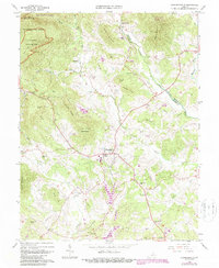
1964 Map of Stanardsville
USGS Topo · Published 1987About this map
Stanardsville serves as the central hub of this Piedmont landscape, situated where the lowlands meet the rising slopes of the Blue Ridge. To the northwest, the wilderness of Shenandoah National Park covers Saddleback Mountain, accessible via the Shenandoah Road. The map documents a deeply established rural community defined by its network of mountain runs and family landmarks, including Brills Shop and the Cecil Mission. Educational and spiritual life is anchored by Monroe High Sch, Stanardsville Sch, and several houses of worship such as Lydia Ch and Mountain View Ch. Waterways like the Conway River and Rapidan River trace the northern boundaries, while Numerous small cemeteries, including McMullen Cem and Shiloh Cem, provide specific points of interest for genealogists tracing local families across the Greene and Madison County line.
Find a feature on this map
60 named features on this map. Tap any name to fly to it.
Don’t see what you’re looking for? This feature index may not catch every label — zoom into the map to look around manually.
Map Details
Editions of this 1964 Stanardsville Map
4 editions found
Other maps of this area

1892 · Gordonsville
USGS Topo · 1:125,000

1892 · Harrisonburg
USGS Topo · 1:125,000

1930 · Madison
USGS Topo · 1:48,000

1931 · University
USGS Topo · 1:62,500

1933 · Madison
USGS Topo · 1:62,500

1935 · Charlottesville
USGS Topo · 1:62,500

1935 · University
USGS Topo · 1:62,500

1937 · Elkton
USGS Topo · 1:62,500

1939 · Charlottesville
USGS Topo · 1:62,500

1949 · Charlottesville
USGS Topo · 1:250,000