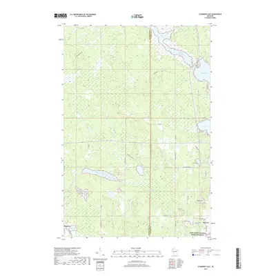
2018 Map of Stanberry East
USGS Topo · Published 2018About this map
Totagatic Flowage and the expansive Nelson Lake dominate the northern terrain of this Sawyer County landscape, where the water systems shape the local geography near the border with Washburn County. The area around Hayward in the southeast is characterized by a network of local roads and family-named landmarks like County Hill, reflecting the modern development and rural residential patterns of northern Wisconsin. The Saint Croix National Scenic Riverway skirts the southern edge, preserving the natural riparian corridor.
Find a feature on this map
45 named features on this map. Tap any name to fly to it.
Don’t see what you’re looking for? This feature index may not catch every label — zoom into the map to look around manually.
Map Details
Editions of this 2018 Stanberry East Map
This is the sole edition of this map. No revisions or reprints were ever made.
Other maps of this area

1944 · Couderay
USGS Topo · 1:48,000

1944 · Hayward
USGS Topo · 1:48,000

1947 · Chittamo
USGS Topo · 1:48,000

1948 · Couderay
USGS Topo · 1:48,000

1948 · Stone Lake
USGS Topo · 1:48,000

1949 · Chittamo
USGS Topo · 1:48,000

1950 · Stone Lake
USGS Topo · 1:48,000

1953 · Ashland
USGS Topo · 1:250,000

1953 · Rice Lake
USGS Topo · 1:250,000

1958 · Ashland
USGS Topo · 1:250,000