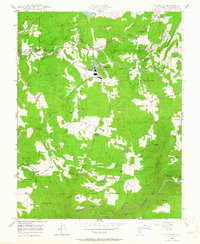
1948 Map of Standard
USGS Topo · Published 1964About this map
Industrial activity and rural homesteads define this mid-century landscape in Tuolumne County. The settlement of Standard serves as a central hub, where the Sierra RR and the Pickering Lumber Co RR converge, highlighting the region's reliance on timber and rail transport. The map records several legacy mining operations from earlier gold-seeking eras, including the Soulsby Mine, Black Oak Mine, and the Russell Telegraph Mine (Aband) near the Tuolumne River.
Find a feature on this map
51 named features on this map. Tap any name to fly to it.
Don’t see what you’re looking for? This feature index may not catch every label — zoom into the map to look around manually.
Map Details
Editions of this 1948 Standard Map
3 editions found
Other maps of this area

1891 · Big Trees
USGS Topo · 1:125,000

1893 · Sonora
USGS Topo · 1:125,000

1894 · Big Trees
USGS Topo · 1:125,000

1896 · Sonora
USGS Topo · 1:125,000

1897 · Sonora
USGS Topo · 1:125,000

1897 · Big Trees
USGS Topo · 1:125,000

1898 · Sonora
USGS Topo · 1:125,000

1901 · Big Trees
USGS Topo · 1:125,000

1947 · Sacramento
USGS Topo · 1:250,000

1947 · San Jose
USGS Topo · 1:250,000