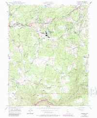
1948 Map of Standard
USGS Topo · Published 1987About this map
Mining and ranching infrastructure define the terrain of Tuolumne County in the late 1940s, where the Standard settlement sits near a complex network of industrial water management. The landscape is crisscrossed by historic water routes including the Sonora Ditch, Shaws Flat Ditch, and Sierra Ditch, which supported the region's extraction and agriculture. To the north, Soulsbyville serves as a hub for the local gold mining legacy, anchored by the Soulsby Mine and nearby Chickenfeed Mine.
Find a feature on this map
51 named features on this map. Tap any name to fly to it.
Don’t see what you’re looking for? This feature index may not catch every label — zoom into the map to look around manually.
Map Details
Editions of this 1948 Standard Map
3 editions found
Other maps of this area

1891 · Big Trees
USGS Topo · 1:125,000

1893 · Sonora
USGS Topo · 1:125,000

1894 · Big Trees
USGS Topo · 1:125,000

1896 · Sonora
USGS Topo · 1:125,000

1897 · Sonora
USGS Topo · 1:125,000

1897 · Big Trees
USGS Topo · 1:125,000

1898 · Sonora
USGS Topo · 1:125,000

1901 · Big Trees
USGS Topo · 1:125,000

1947 · Sacramento
USGS Topo · 1:250,000

1947 · San Jose
USGS Topo · 1:250,000