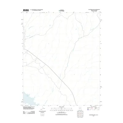
2011 Map of Standard Wash
USGS Topo · Published 2011About this map
Lake Havasu and the Colorado River define the southwestern corner of this desert landscape, where the water meets the arid drainage systems of Mohave County. The map is dominated by a complex network of dry washes that channel seasonal runoff toward the river, most notably the extensive Standard Wash which winds across the center of the quadrangle. Highlighting the scarce water resources of the region, the survey identifies localized water sources such as Screwbean Spring and Gold Spring in the northern reaches. Settlement patterns are sparse, with development largely confined to the western edge near Martinique Dr, signaling the fringe of Lake Havasu City's residential growth. Inland access is provided by unpaved tracks like Screwbean Well Rd, reflecting the area's use for recreation and resource management in the early twenty-first century.
Find a feature on this map
9 named features on this map. Tap any name to fly to it.
Don’t see what you’re looking for? This feature index may not catch every label — zoom into the map to look around manually.
Map Details
Editions of this 2011 Standard Wash Map
This is the sole edition of this map. No revisions or reprints were ever made.
Other maps of this area

1903 · Needles
USGS Topo · 1:125,000

1904 · Needles Special
USGS Topo · 1:125,000

1911 · Parker
USGS Topo · 1:125,000

1927 · Buck Mountains
USGS Topo · 1:62,500

1929 · Buck Mountains
USGS Topo · 1:62,500

1943 · Giers Basin
USGS Topo · 1:62,500

1943 · Topock
USGS Topo · 1:62,500

1943 · Whipple Mts.
USGS Topo · 1:62,500

1950 · Parker Dam Area
USGS Topo · 1:62,500

1950 · Topock
USGS Topo · 1:62,500