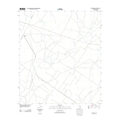
2012 Map of Standart
USGS Topo · Published 2012About this map
Standart and Pinto define the small-town character of this Kinney County landscape, where the sparse West Texas infrastructure meets a network of vital water sources. The map reveals a ranching economy reliant on the winding paths of Pinto Cr and Perdido Cr, which carve through the dry terrain alongside the smaller Little Perdido Cr. This drainage system, including Cow Cr and Elm Cr, highlights the importance of water management in a region where isolated springs, such as Stricklin Spring, were essential landmarks for early settlers and modern livestock operations alike.
Find a feature on this map
13 named features on this map. Tap any name to fly to it.
Don’t see what you’re looking for? This feature index may not catch every label — zoom into the map to look around manually.
Map Details
Editions of this 2012 Standart Map
This is the sole edition of this map. No revisions or reprints were ever made.
Other maps of this area

1896 · Brackett
USGS Topo · 1:125,000

1897 · Brackett
USGS Topo · 1:125,000

1941 · Standart
USGS Topo · 1:62,500

1941 · Tequesquite Creek
USGS Topo · 1:62,500

1943 · Standart
USGS Topo · 1:62,500

1944 · Tequesquite Creek
USGS Topo · 1:62,500

1944 · Spofford
USGS Topo · 1:62,500

1944 · Brackettville
USGS Topo · 1:62,500

1958 · Del Rio
USGS Topo · 1:250,000

1964 · Del Rio
USGS Topo · 1:250,000