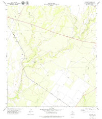
1979 Map of Standart
USGS Topo · Published 1979About this map
Standart sits along the Southern Pacific rail line in this arid region of Kinney County, where the landscape is defined by the winding drainages of the Pinto Creek system. The map reveals an environment focused on water management and resource extraction during the late 1970s, evidenced by numerous wells and several drill holes scattered across the brushland. Natural water sources like Stricklin Spring provide vital points of interest in a terrain marked by the convergence of Little Perdido Creek, West Pinto Creek, and Cow Creek. Transportation is anchored by the rail corridor and U.S. Route 90, which features a dedicated Roadside Park for travelers. The presence of multiple gravel pits near the railway suggests local industrial activity supporting the infrastructure of this South Texas ranching country.
Find a feature on this map
15 named features on this map. Tap any name to fly to it.
Don’t see what you’re looking for? This feature index may not catch every label — zoom into the map to look around manually.
Map Details
Editions of this 1979 Standart Map
This is the sole edition of this map. No revisions or reprints were ever made.
Other maps of this area

1896 · Brackett
USGS Topo · 1:125,000

1897 · Brackett
USGS Topo · 1:125,000

1941 · Standart
USGS Topo · 1:62,500

1941 · Tequesquite Creek
USGS Topo · 1:62,500

1943 · Standart
USGS Topo · 1:62,500

1944 · Tequesquite Creek
USGS Topo · 1:62,500

1944 · Spofford
USGS Topo · 1:62,500

1944 · Brackettville
USGS Topo · 1:62,500

1958 · Del Rio
USGS Topo · 1:250,000

1964 · Del Rio
USGS Topo · 1:250,000