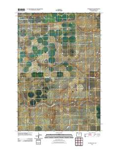
2011 Map of Stanfield SE
USGS Topo · Published 2011About this map
Cold Springs Reservoir dominates the northwestern corner of this Umatilla County landscape, serving as a vital water source in an otherwise arid drainage system. The map reveals a grid of rural infrastructure essential to the region's agricultural and transit history, including Stage Gulch Rd and Despain Gulch Rd. These corridors follow the natural depressions of the terrain, tracing the routes that historically connected local farmsteads. The presence of Wells Station Rd points to earlier era transit points, while the network of county roads like Co 1172 Rd and Co 997 Rd illustrates the organized division of land into large-scale parcels typical of eastern Oregon's plateau country.
Find a feature on this map
8 named features on this map. Tap any name to fly to it.
Don’t see what you’re looking for? This feature index may not catch every label — zoom into the map to look around manually.
Map Details
Editions of this 2011 Stanfield SE Map
This is the sole edition of this map. No revisions or reprints were ever made.
Other maps of this area

1908 · Umatilla
USGS Topo · 1:125,000

1935 · Pendleton
USGS Topo · 1:125,000

1953 · Pendleton
USGS Topo · 1:250,000

1956 · Pendleton
USGS Topo · 1:250,000

1962 · Hat Rock
USGS Topo · 1:24,000

1962 · Stanfield
USGS Topo · 1:24,000

1962 · Juniper
USGS Topo · 1:24,000

1962 · Stanfield SE
USGS Topo · 1:24,000
1966 · Juniper Canyon
USGS Topo · 1:24,000

1966 · Holdman
USGS Topo · 1:24,000