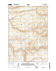
2014 Map of Stanfield SE
USGS Topo · Published 2014About this map
Cold Springs Reservoir and the rugged drainage of Cold Springs Canyon define the northern reaches of this Umatilla County landscape. The area is characterized by a series of significant seasonal watercourses and ridges, including Despain Gulch and Stage Gulch, which cut through the agricultural and grazing lands of the Columbia Basin. The map provides a detailed look at the local road network that supports this rural economy, tracing routes like Kosmos Rd and Kilgore Rd. Of particular interest to local historians is the site of Wells Station Rd and Wells Stn Rd, indicating the historical significance of travel and transit points across this part of Oregon. Other local thoroughfares like Moorehouse Rd and Stage Gulch Rd provide essential connections between the high plateaus and the canyon floors.
Find a feature on this map
17 named features on this map. Tap any name to fly to it.
Don’t see what you’re looking for? This feature index may not catch every label — zoom into the map to look around manually.
Map Details
Editions of this 2014 Stanfield SE Map
This is the sole edition of this map. No revisions or reprints were ever made.
Other maps of this area

1908 · Umatilla
USGS Topo · 1:125,000

1935 · Pendleton
USGS Topo · 1:125,000

1953 · Pendleton
USGS Topo · 1:250,000

1956 · Pendleton
USGS Topo · 1:250,000

1962 · Hat Rock
USGS Topo · 1:24,000

1962 · Stanfield
USGS Topo · 1:24,000

1962 · Juniper
USGS Topo · 1:24,000

1962 · Stanfield SE
USGS Topo · 1:24,000
1966 · Juniper Canyon
USGS Topo · 1:24,000

1966 · Holdman
USGS Topo · 1:24,000