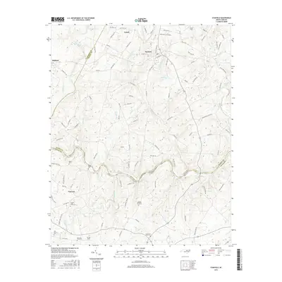
2016 Map of Stanfield
USGS Topo · Published 2016About this map
Rocky River winds through the heart of this landscape, carving a boundary between the communities of Locust, Stanfield, Midland, and Fairview. The map reveals a dense network of country roads and family-named landmarks that speak to the region's deep agricultural and religious roots. Numerous historic churchyards and burial grounds are documented, including the Antioch Methodist Church Cem and the Austin Family Cem, which serve as vital touchstones for genealogical research in this part of Union and Stanly Counties.
Find a feature on this map
97 named features on this map. Tap any name to fly to it.
Don’t see what you’re looking for? This feature index may not catch every label — zoom into the map to look around manually.
Map Details
Editions of this 2016 Stanfield Map
This is the sole edition of this map. No revisions or reprints were ever made.
Other maps of this area

1941 · Charlotte
USGS Topo · 1:125,000

1942 · Charlotte
USGS Topo · 1:125,000

1949 · Midland
USGS Topo · 1:24,000

1949 · Concord SE
USGS Topo · 1:24,000

1953 · Charlotte
USGS Topo · 1:250,000

1954 · Charlotte
USGS Topo · 1:250,000

1957 · Mount Pleasant
USGS Topo · 1:62,500

1960 · Charlotte
USGS Topo · 1:250,000

1962 · Charlotte
USGS Topo · 1:250,000
1969 · Concord SE
USGS Topo · 1:24,000