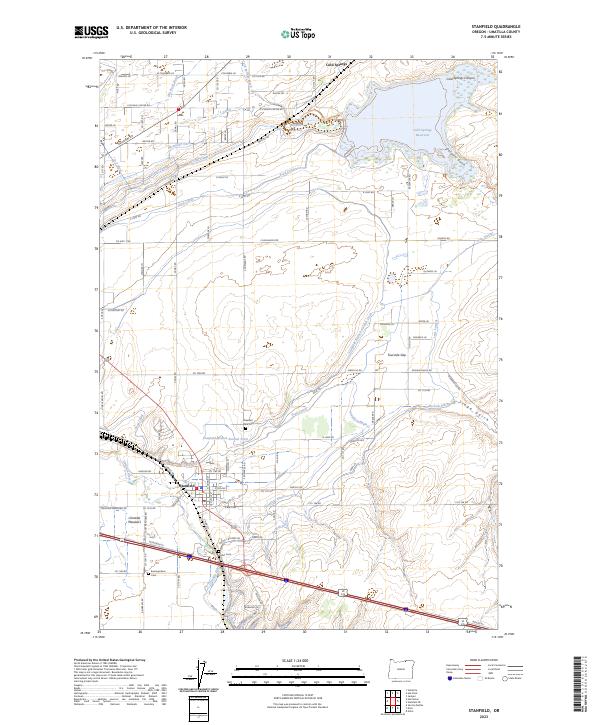
2023 Map of Stanfield
USGS Topo · Published 2023About this map
The Umatilla River valley defines this part of the Oregon high desert, where a complex network of irrigation infrastructure transformed the landscape. A sophisticated system of water management is visible through features like the Maxwell Canal, Hermiston Ditch, and the Stanfield Drain, which divert water to support local agriculture. The northern portion of the map is dominated by the Cold Springs National Wildlife Refuge, centered on the Cold Springs Reservoir.
Find a feature on this map
73 named features on this map. Tap any name to fly to it.
Don’t see what you’re looking for? This feature index may not catch every label — zoom into the map to look around manually.
Map Details
Editions of this 2023 Stanfield Map
This is the sole edition of this map. No revisions or reprints were ever made.
Other maps of this area

1908 · Umatilla
USGS Topo · 1:125,000

1953 · Pendleton
USGS Topo · 1:250,000

1956 · Pendleton
USGS Topo · 1:250,000

1962 · Hat Rock
USGS Topo · 1:24,000

1962 · Stanfield
USGS Topo · 1:24,000

1962 · Hermiston
USGS Topo · 1:24,000

1962 · Juniper
USGS Topo · 1:24,000

1962 · Umatilla
USGS Topo · 1:24,000

1962 · Stanfield SE
USGS Topo · 1:24,000
1968 · Echo
USGS Topo · 1:24,000