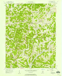
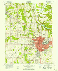
1956 Map of Stanford
USGS Topo · Published 1967About this map
Stanford and Elwren anchor the higher ground in this mid-century survey of the rugged Greene and Monroe County borderlands. The Illinois Central railroad cuts across the northern landscape, winding through a series of creek valleys and ridges where rural life was centered around local institutions like Sanborn Sch and Greene Co Chapel. The terrain is deeply dissected by the drainages of Beech Creek and Indian Creek, creating a complex network of hollows such as Lawrence Hollow.
Find a feature on this map
33 named features on this map. Tap any name to fly to it.
Don’t see what you’re looking for? This feature index may not catch every label — zoom into the map to look around manually.
Map Details
Editions of this 1956 Stanford Map
3 editions found
Other maps of this area

1908 · Bloomington
USGS Topo · 1:48,000

1908 · Bloomfield
USGS Topo · 1:62,500

1910 · Bloomington
USGS Topo · 1:62,500

1935 · Oolitic
USGS Topo · 1:48,000

1942 · Oolitic
USGS Topo · 1:62,500

1953 · Indianapolis
USGS Topo · 1:250,000

1956 · Indianapolis
USGS Topo · 1:250,000
1956 · Clear Creek
USGS Topo · 1:24,000

1956 · Freedom
USGS Topo · 1:24,000
1956 · Bloomington
USGS Topo · 1:24,000