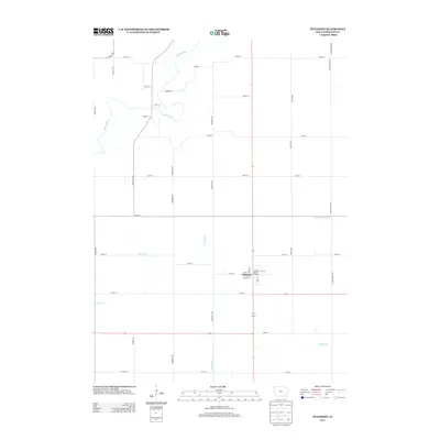
2013 Map of Stanhope
USGS Topo · Published 2013About this map
The town of Stanhope serves as the central hub of this Hamilton County landscape, situated at the intersection of several local thoroughfares including Main St and Adams St. This 2013 survey illustrates the agricultural grid of Central Iowa, where the winding course of the Boone River in the northwest contrasts with the precision of local drainage systems like the Rahto Branch Ditch. Local history and preservation are represented by the Country Relics Village, located on the eastern edge of the main settlement. The surrounding territory is defined by a network of creeks and branches, including Crooked Cr, Squaw Cr, and Keigley Br, which cut through the section lines of the township. Noteworthy rural roads such as Tunnel Mill Rd and Inkpaduta Ave provide access to the outlying farmsteads that characterize this portion of the Iowa prairie.
Find a feature on this map
37 named features on this map. Tap any name to fly to it.
Don’t see what you’re looking for? This feature index may not catch every label — zoom into the map to look around manually.
Map Details
Editions of this 2013 Stanhope Map
This is the sole edition of this map. No revisions or reprints were ever made.
Other maps of this area

1912 · Ames
USGS Topo · 1:62,500

1914 · Ames
USGS Topo · 1:62,500

1916 · Boone
USGS Topo · 1:62,500

1954 · Waterloo
USGS Topo · 1:250,000

1955 · Waterloo
USGS Topo · 1:250,000

1965 · Mackey
USGS Topo · 1:24,000

1965 · Fraser
USGS Topo · 1:24,000

1975 · Ames NW
USGS Topo · 1:24,000

1978 · Blairsburg
USGS Topo · 1:24,000

1978 · Webster City
USGS Topo · 1:24,000