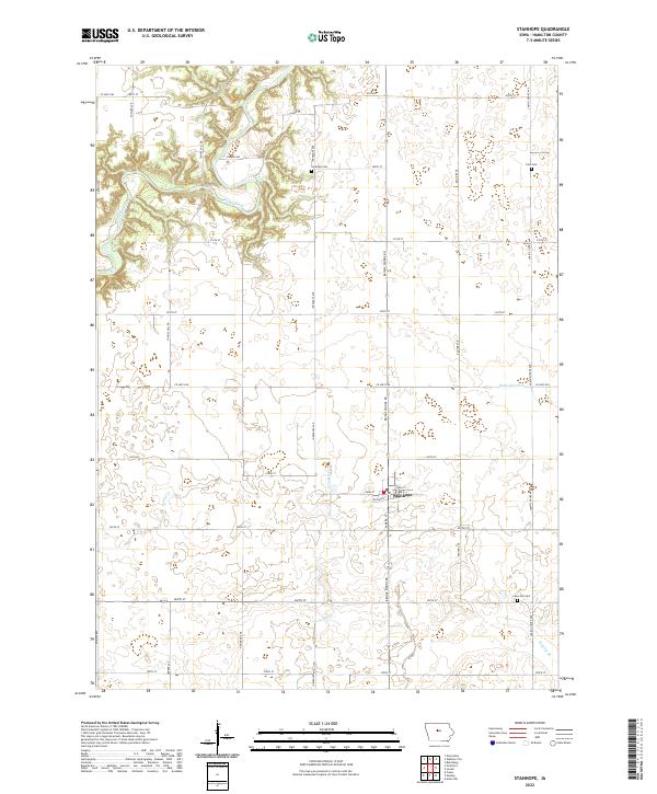
2022 Map of Stanhope
USGS Topo · Published 2022About this map
The town of Stanhope serves as the central hub of this Hamilton County landscape, situated at the intersection of several key regional thoroughfares. The terrain is characterized by a high concentration of wetlands and drainage features, including the Boone River which meanders through the northwest, and managed waterways like the Rahto-Br-Ditch. This intricate water network reflects the agricultural intensity of the region, where natural creeks such as Crooked Cr, Ioway Cr, and Keigley Br integrate with a rigid section-line road grid. For those researching local heritage, several historic burial sites are preserved across the townships, including Saratoga Cem near the river, Zion Cem to the northeast, and Lawn Hill Cem in the southeast. These landmarks, along with the grid of county roads like Briggs Woods Rd and Lakin's Grove Ave, provide a detailed framework for understanding the rural settlement patterns of central Iowa.
Find a feature on this map
38 named features on this map. Tap any name to fly to it.
Don’t see what you’re looking for? This feature index may not catch every label — zoom into the map to look around manually.
Map Details
Editions of this 2022 Stanhope Map
This is the sole edition of this map. No revisions or reprints were ever made.
Other maps of this area

1912 · Ames
USGS Topo · 1:62,500

1914 · Ames
USGS Topo · 1:62,500

1916 · Boone
USGS Topo · 1:62,500

1954 · Waterloo
USGS Topo · 1:250,000

1955 · Waterloo
USGS Topo · 1:250,000

1965 · Mackey
USGS Topo · 1:24,000

1965 · Fraser
USGS Topo · 1:24,000

1975 · Ames NW
USGS Topo · 1:24,000

1978 · Blairsburg
USGS Topo · 1:24,000

1978 · Webster City
USGS Topo · 1:24,000