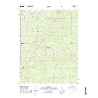
2018 Map of Stanislaus
USGS Topo · Published 2018About this map
Arnold and Hathaway Pines anchor the northwestern portion of this 2018 survey, where residential developments like Rancho Paradiso meet the steep canyons of the Stanislaus National Forest. The landscape is defined by the deep incisions of the Middle Fork Stanislaus River and the North Fork Stanislaus River, which converge near the settlement of Stanislaus. Evidence of historical water management and mining-era infrastructure is visible in the winding path of the Utica Ditch and the Utica Ditch Road, which trace the contours above the river canyons. Significant elevation changes are marked by landmarks like Doud Hill and Cone Hill, while the Stanislaus Tunnel and McKays Point highlight the engineering required to navigate this portion of the Sierra Nevada. Smaller clearings and drainage features such as McCormick Meadows and Stony Gulch provide a more intimate look at the local geography between the river forks.
Find a feature on this map
67 named features on this map. Tap any name to fly to it.
Don’t see what you’re looking for? This feature index may not catch every label — zoom into the map to look around manually.
Map Details
Editions of this 2018 Stanislaus Map
This is the sole edition of this map. No revisions or reprints were ever made.
Other maps of this area

1891 · Big Trees
USGS Topo · 1:125,000

1894 · Big Trees
USGS Topo · 1:125,000

1897 · Big Trees
USGS Topo · 1:125,000

1901 · Big Trees
USGS Topo · 1:125,000

1947 · Sacramento
USGS Topo · 1:250,000

1948 · Sacramento
USGS Topo · 1:250,000

1948 · Columbia
USGS Topo · 1:62,500
1948 · Columbia SE
USGS Topo · 1:24,000
1948 · Columbia
USGS Topo · 1:24,000
1948 · Murphys
USGS Topo · 1:24,000