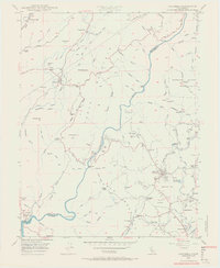
1948 Map of Columbia
USGS Topo · Published 1956About this map
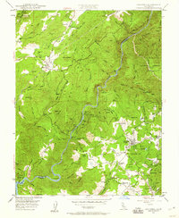
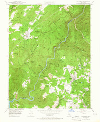
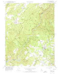
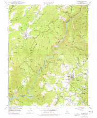
Columbia Historic State Park stands as the centerpiece of this Mother Lode survey, capturing the preservation of an iconic gold-rush town alongside active ranching and mining operations in the late 1940s. The landscape is defined by the winding Stanislaus River and the massive silhouette of Table Mountain, which cuts through the center of the sheet. Historically significant settlements like Columbia, Vallecito, and Douglas Flat are shown with their early 20th-century footprints, connected by complex water systems such as the Columbia Ditch and Utica Ditch.
Find a feature on this map
103 named features on this map. Tap any name to fly to it.
Don’t see what you’re looking for? This feature index may not catch every label — zoom into the map to look around manually.
Map Details
Editions of this 1948 Columbia Map
5 editions found
Other maps of this area

1889 · Jackson
USGS Topo · 1:125,000

1891 · Big Trees
USGS Topo · 1:125,000

1892 · Jackson
USGS Topo · 1:125,000

1893 · Sonora
USGS Topo · 1:125,000

1894 · Big Trees
USGS Topo · 1:125,000

1896 · Sonora
USGS Topo · 1:125,000

1897 · Jackson
USGS Topo · 1:125,000

1897 · Sonora
USGS Topo · 1:125,000

1897 · Big Trees
USGS Topo · 1:125,000

1898 · Sonora
USGS Topo · 1:125,000