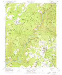
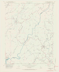
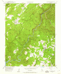
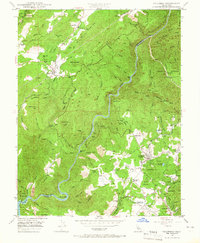
1948 Map of Columbia
USGS Topo · Published 1977About this map
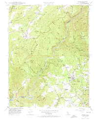
Gold Country history is preserved across this landscape where the Stanislaus River carves a deep canyon between Table Mountain and the surrounding peaks. The area is dense with legacy mining operations, ranging from the Golden River Mine and Vine Spring Mine to the extensive Marble Quarries near the riverbanks. The settlement of Columbia remains a focal point, supported by the Columbia Historic State Park and proximity to Columbia Airport.
Find a feature on this map
96 named features on this map. Tap any name to fly to it.
Don’t see what you’re looking for? This feature index may not catch every label — zoom into the map to look around manually.
Map Details
Editions of this 1948 Columbia Map
5 editions found
Other maps of this area

1889 · Jackson
USGS Topo · 1:125,000

1891 · Big Trees
USGS Topo · 1:125,000

1892 · Jackson
USGS Topo · 1:125,000

1893 · Sonora
USGS Topo · 1:125,000

1894 · Big Trees
USGS Topo · 1:125,000

1896 · Sonora
USGS Topo · 1:125,000

1897 · Jackson
USGS Topo · 1:125,000

1897 · Sonora
USGS Topo · 1:125,000

1897 · Big Trees
USGS Topo · 1:125,000

1898 · Sonora
USGS Topo · 1:125,000