1948 Map of Columbia
USGS Topo · Published 1974About this map
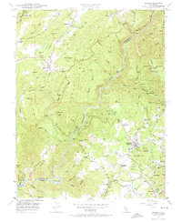
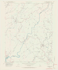
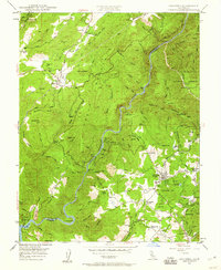
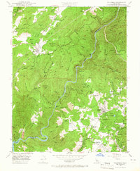
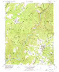
Columbia and the surrounding Gold Country foothills are captured in detail during the late 1940s, a period when the area was transitioning from an active resource-extraction region to a site of historical preservation. The map highlights the Columbia Historic State Park, reflecting early efforts to protect the unique architecture of the mining boom. Hard-rock mining and quarrying operations are still prominent features of the landscape, with the Carson Hill Mine, Henning Mine, and several Marble Quarries dotting the terrain. The Stanislaus River carves a deep canyon through the center, separating Calaveras and Tuolumne counties.
Find a feature on this map
99 named features on this map. Tap any name to fly to it.
Don’t see what you’re looking for? This feature index may not catch every label — zoom into the map to look around manually.
Map Details
Editions of this 1948 Columbia Map
5 editions found
Other maps of this area

1889 · Jackson
USGS Topo · 1:125,000

1891 · Big Trees
USGS Topo · 1:125,000

1892 · Jackson
USGS Topo · 1:125,000

1893 · Sonora
USGS Topo · 1:125,000

1894 · Big Trees
USGS Topo · 1:125,000

1896 · Sonora
USGS Topo · 1:125,000

1897 · Jackson
USGS Topo · 1:125,000

1897 · Sonora
USGS Topo · 1:125,000

1897 · Big Trees
USGS Topo · 1:125,000

1898 · Sonora
USGS Topo · 1:125,000