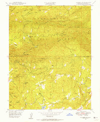
1948 Map of Columbia SE
USGS Topo · Published 1956About this map
Gold mining operations and steep river canyons dominate this mid-century survey of the Stanislaus National Forest region. The landscape is defined by the South Fork Stanislaus River and its numerous tributaries, including Fivemile Creek and Woods Creek. Hardrock mining remains a visible legacy across the terrain, with specific sites like the Lucky Strike Mine, Shanghai Mine, and Grant Mine following the veins between Contention Ridge and Telegraph Hill.
Find a feature on this map
73 named features on this map. Tap any name to fly to it.
Don’t see what you’re looking for? This feature index may not catch every label — zoom into the map to look around manually.
Map Details
Editions of this 1948 Columbia SE Map
4 editions found
Other maps of this area

1891 · Big Trees
USGS Topo · 1:125,000

1893 · Sonora
USGS Topo · 1:125,000

1894 · Big Trees
USGS Topo · 1:125,000

1896 · Sonora
USGS Topo · 1:125,000

1897 · Sonora
USGS Topo · 1:125,000

1897 · Big Trees
USGS Topo · 1:125,000

1898 · Sonora
USGS Topo · 1:125,000

1901 · Big Trees
USGS Topo · 1:125,000

1947 · Sacramento
USGS Topo · 1:250,000

1947 · San Jose
USGS Topo · 1:250,000