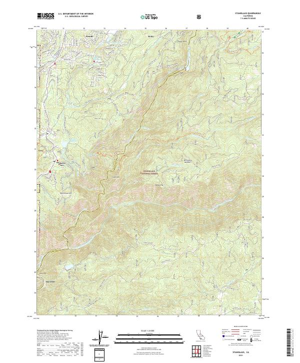
2021 Map of Stanislaus
USGS Topo · Published 2021About this map
Arnold and Hathaway Pines sit along the northwestern edge of this landscape, marking a transition from residential developments into the dense timber of the Stanislaus National Forest. The geography is defined by a series of steep drainages, most notably the Middle Fork Stanislaus River and the North Fork Stanislaus River, which converge near the southern settlement of Stanislaus. Water management for power and irrigation is evident through the winding path of the Utica Ditch and its associated Utica Ditch Road, alongside mountain reservoirs like Fly in Acres Reservoir and Pinebrook Reservoir. Extensive forest road networks, such as Forest Rte 5N35 and Forest Rte 4N04, penetrate the higher elevations of Doud Hill and McKays Point, providing access to remote locations like McCormick Meadows.
Find a feature on this map
53 named features on this map. Tap any name to fly to it.
Don’t see what you’re looking for? This feature index may not catch every label — zoom into the map to look around manually.
Map Details
Editions of this 2021 Stanislaus Map
This is the sole edition of this map. No revisions or reprints were ever made.
Other maps of this area

1891 · Big Trees
USGS Topo · 1:125,000

1894 · Big Trees
USGS Topo · 1:125,000

1897 · Big Trees
USGS Topo · 1:125,000

1901 · Big Trees
USGS Topo · 1:125,000

1947 · Sacramento
USGS Topo · 1:250,000

1948 · Sacramento
USGS Topo · 1:250,000

1948 · Columbia
USGS Topo · 1:62,500
1948 · Columbia SE
USGS Topo · 1:24,000
1948 · Columbia
USGS Topo · 1:24,000
1948 · Murphys
USGS Topo · 1:24,000