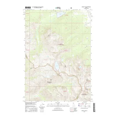
2017 Map of Stanley Lake
USGS Topo · Published 2017About this map
Stanley Lake sits at the northern edge of this high-elevation landscape, where the Challis National Forest, Boise National Forest, and Sawtooth National Forest converge. The topography is dominated by the jagged spires of the Sawtooth Range, featuring prominent summits such as Mt Regan, McGowan Peak, and Thompson Peak. This high-country survey documents a complex network of glacial basins and alpine water bodies, including Sawtooth Lake and the smaller Hanson Lakes. Drainage systems like Stanley Lake Creek and Crooked Creek carve through the steep terrain, while landmarks such as Lady Face Falls and Bridal Veil Falls denote significant drops in the watershed. The map provides a precise record of the remote boundary between Boise County and Custer County as it follows the high ridgelines.
Find a feature on this map
41 named features on this map. Tap any name to fly to it.
Don’t see what you’re looking for? This feature index may not catch every label — zoom into the map to look around manually.
Map Details
Editions of this 2017 Stanley Lake Map
This is the sole edition of this map. No revisions or reprints were ever made.
Other maps of this area

1891 · Bear Valley
USGS Topo · 1:125,000

1893 · Bear Valley
USGS Topo · 1:125,000

1919 · Custer
USGS Topo · 1:125,000

1922 · Custer
USGS Topo · 1:125,000

1957 · Challis
USGS Topo · 1:250,000

1960 · Challis
USGS Topo · 1:250,000

1963 · Challis
USGS Topo · 1:250,000

1963 · Mt Cramer
USGS Topo · 1:24,000

1963 · Stanley
USGS Topo · 1:24,000

1963 · Basin Butte
USGS Topo · 1:24,000