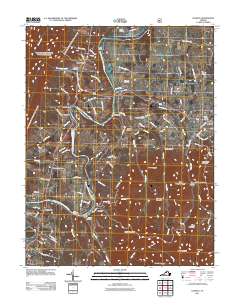
2011 Map of Stanley
USGS Topo · Published 2011About this map
The South Fork Shenandoah River winds through the heart of this Page County landscape, dictating the placement of early infrastructure and river-crossings. The waterway is anchored by the Newport Dam near Newport and the Grove Hill Landing further downstream at Grove Hill. These features, alongside the clustered cemeteries like Saint Pauls Cemetery and Saint Luke Cemetery, suggest the deep-rooted settlement patterns of the Shenandoah Valley.
Find a feature on this map
99 named features on this map. Tap any name to fly to it.
Don’t see what you’re looking for? This feature index may not catch every label — zoom into the map to look around manually.
Map Details
Editions of this 2011 Stanley Map
This is the sole edition of this map. No revisions or reprints were ever made.
Other maps of this area

1892 · Woodstock
USGS Topo · 1:125,000

1892 · Gordonsville
USGS Topo · 1:125,000

1892 · Harrisonburg
USGS Topo · 1:125,000

1893 · Luray
USGS Topo · 1:125,000

1905 · Luray
USGS Topo · 1:125,000

1929 · Stony Man
USGS Topo · 1:48,000

1930 · Madison
USGS Topo · 1:48,000

1933 · Stony Man
USGS Topo · 1:62,500

1933 · Madison
USGS Topo · 1:62,500

1937 · Elkton
USGS Topo · 1:62,500