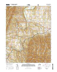
2016 Map of Stanley
USGS Topo · Published 2016About this map
The South Fork Shenandoah River winds through the heart of the Page Valley, defining the agricultural and residential layout of this Virginia landscape. To the east, the steep rising slopes of Shenandoah National Park are dominated by prominent peaks such as Cubbage Mtn and Dovel Mtn, while the western edge is bordered by the George Washington National Forest. Small settlements like Stanley, Honeyville, and Newport are connected by a network of rural roads that follow the natural contours of the valley floor. Genealogists will find a wealth of local history in the numerous burial grounds scattered across the quadrangle, including Saint Luke Cem, Leaks Chapel Cem, and Comer Cem. This survey illustrates the delicate balance between the high ridge lines of Dog Slaughter Ridge and the fertile riverfront communities near Grove Hill.
Find a feature on this map
125 named features on this map. Tap any name to fly to it.
Don’t see what you’re looking for? This feature index may not catch every label — zoom into the map to look around manually.
Map Details
Editions of this 2016 Stanley Map
This is the sole edition of this map. No revisions or reprints were ever made.
Other maps of this area

1892 · Woodstock
USGS Topo · 1:125,000

1892 · Gordonsville
USGS Topo · 1:125,000

1892 · Harrisonburg
USGS Topo · 1:125,000

1893 · Luray
USGS Topo · 1:125,000

1905 · Luray
USGS Topo · 1:125,000

1929 · Stony Man
USGS Topo · 1:48,000

1930 · Madison
USGS Topo · 1:48,000

1933 · Stony Man
USGS Topo · 1:62,500

1933 · Madison
USGS Topo · 1:62,500

1937 · Elkton
USGS Topo · 1:62,500