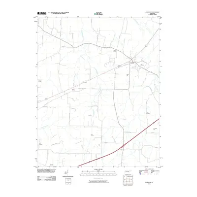
2010 Map of Stanton
USGS Topo · Published 2010About this map
Stanton serves as the central hub of this agricultural landscape in West Tennessee, where the town's grid meets the branching paths of the Big Muddy Creek and Little Muddy Creek systems. The map reveals a dense distribution of family and community burial grounds, essential for genealogical research in Haywood County. These sites, including Collier Cemeteries, Cole Cemetery, and Scrub Oak Cemetery, are scattered across the terrain alongside landmarks like Meux Hill and Fortescue Hill. A network of named rural roads, such as Greenleaf Cemetery Rd and Keeling Rd, connects these sites, reflecting a long-standing settlement pattern defined by small-scale farming and the seasonal flow of East Beaver Creek. The integration of local lane names like Rena Anderson Rd and Maclin Riley Rd provides specific geographic markers for tracing ancestral landholdings and community boundaries.
Find a feature on this map
48 named features on this map. Tap any name to fly to it.
Don’t see what you’re looking for? This feature index may not catch every label — zoom into the map to look around manually.
Map Details
Editions of this 2010 Stanton Map
This is the sole edition of this map. No revisions or reprints were ever made.
Other maps of this area

1950 · Brownsville
USGS Topo · 1:24,000

1951 · Brownsville
USGS Topo · 1:24,000

1952 · Stanton
USGS Topo · 1:24,000

1952 · Lambert
USGS Topo · 1:24,000

1952 · Dancyville
USGS Topo · 1:24,000

1952 · Laconia
USGS Topo · 1:24,000

1952 · Stanton
USGS Topo · 1:62,500

1954 · Mason
USGS Topo · 1:62,500

1956 · Blytheville
USGS Topo · 1:250,000

1959 · Blytheville
USGS Topo · 1:250,000