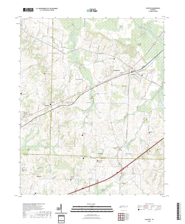
2022 Map of Stanton
USGS Topo · Published 2022About this map
Stanton sits at the junction of rail and road in this West Tennessee landscape, where the agricultural plains meet the complex drainage systems of Hatchie Bottom. The terrain is defined by engineered waterways like the Big Muddy Canal and Little Muddy Canal, which were designed to manage the low-lying wetlands of Haywood County. This area is exceptionally dense with genealogical landmarks, particularly family and community burial grounds such as the Core Family Cem, Collier Cemeteries, and the First Baptist Keeling Cem.
Find a feature on this map
83 named features on this map. Tap any name to fly to it.
Don’t see what you’re looking for? This feature index may not catch every label — zoom into the map to look around manually.
Map Details
Editions of this 2022 Stanton Map
This is the sole edition of this map. No revisions or reprints were ever made.
Other maps of this area

1950 · Brownsville
USGS Topo · 1:24,000

1951 · Brownsville
USGS Topo · 1:24,000

1952 · Stanton
USGS Topo · 1:24,000

1952 · Lambert
USGS Topo · 1:24,000

1952 · Dancyville
USGS Topo · 1:24,000

1952 · Laconia
USGS Topo · 1:24,000

1952 · Stanton
USGS Topo · 1:62,500

1954 · Mason
USGS Topo · 1:62,500

1956 · Blytheville
USGS Topo · 1:250,000

1959 · Blytheville
USGS Topo · 1:250,000