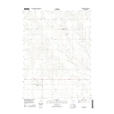
2014 Map of Staplehurst
USGS Topo · Published 2014About this map
Staplehurst and the surrounding Seward County countryside are defined by a grid of agricultural section roads and the winding path of the Big Blue River. This landscape is dotted with generational landmarks, including numerous burial grounds such as Staplehurst Cem, Immanuel Cem, and American Cem to the north. Further south, the settlement of Tamora sits along the Ne-80g-Link rail corridor, accompanied by Tamora Cem. The drainage patterns are clearly visible through the courses of Lincoln Cr, Cottonwood Cr, and Brush Cr, which feed into local catchments like Dobesh-Swanson Reservoir and Herpolsheimer Reservoir. The prevalence of named cemeteries and family-named reservoirs highlights the deeply rooted rural community and its reliance on the local watershed for both infrastructure and tradition.
Find a feature on this map
40 named features on this map. Tap any name to fly to it.
Don’t see what you’re looking for? This feature index may not catch every label — zoom into the map to look around manually.
Map Details
Editions of this 2014 Staplehurst Map
This is the sole edition of this map. No revisions or reprints were ever made.
Other maps of this area

1899 · David City
USGS Topo · 1:125,000

1934 · Seward
USGS Topo · 1:48,000

1934 · Utica
USGS Topo · 1:62,500

1937 · Utica
USGS Topo · 1:62,500

1939 · Seward
USGS Topo · 1:62,500

1955 · Fremont
USGS Topo · 1:250,000

1955 · Lincoln
USGS Topo · 1:250,000

1957 · Fremont
USGS Topo · 1:250,000

1957 · Lincoln
USGS Topo · 1:250,000

1958 · Fremont
USGS Topo · 1:250,000