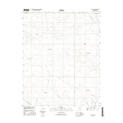
2017 Map of Star Lake
USGS Topo · Published 2017About this map
Chaco Wash and its many tributaries, including Salazar Wash and Daniel Wash, dominate this high-desert landscape in McKinley County. The settlement at Star Lake is the primary human landmark, serving as a focal point for a network of desert routes such as Star Lake Rd and Indian Svc Rte 9. The terrain is characterized by dramatic elevation changes, most notably the prominent Pot Mesa to the northwest and the expansive Ceja del Raton rim to the east. Water, a precious resource in this arid region, is concentrated in features like Calladito Lakes, Franciscan Lake, and Papers Lake. The presence of several pipeline corridors, including Pipeline Rd, illustrates the intersection of traditional land use with modern utility infrastructure across the open range.
Find a feature on this map
28 named features on this map. Tap any name to fly to it.
Don’t see what you’re looking for? This feature index may not catch every label — zoom into the map to look around manually.
Map Details
Editions of this 2017 Star Lake Map
This is the sole edition of this map. No revisions or reprints were ever made.
Other maps of this area

1883 · Mt. Taylor
USGS Topo · 1:250,000

1886 · Mt. Taylor
USGS Topo · 1:250,000

1889 · Largo
USGS Topo · 1:250,000

1892 · Mt. Taylor
USGS Topo · 1:250,000

1895 · Largo
USGS Topo · 1:250,000

1899 · Mt. Taylor
USGS Topo · 1:250,000

1954 · Aztec
USGS Topo · 1:250,000

1958 · Aztec
USGS Topo · 1:250,000

1958 · Albuquerque
USGS Topo · 1:250,000

1960 · Pueblo Alto Trading Post
USGS Topo · 1:24,000