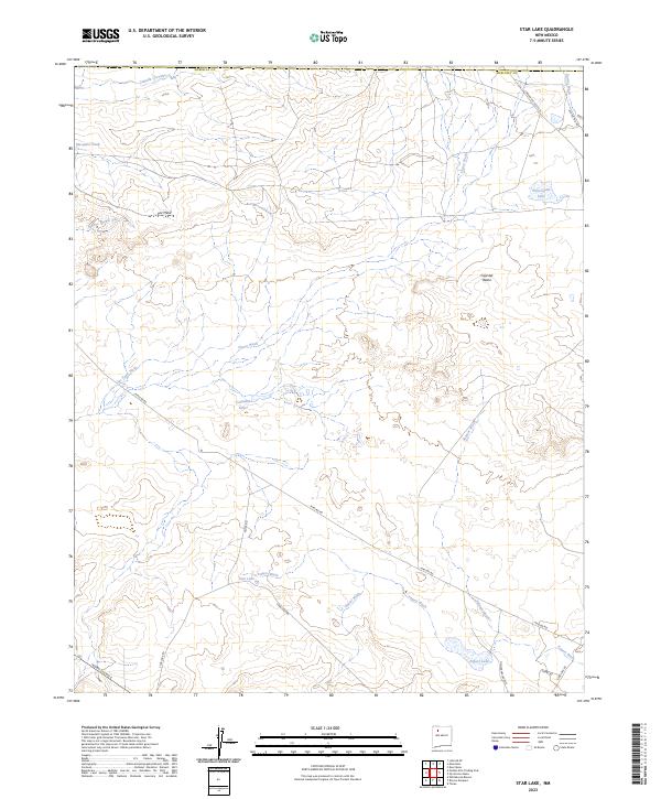
2023 Map of Star Lake
USGS Topo · Published 2023About this map
Pot Mesa and the elevated ridgeline of Ceja del Raton dominate this high-desert landscape in McKinley County. The terrain is defined by a complex drainage system where ephemeral watercourses like Chaco Wash, Salazar Wash, and Papers Wash carve through the arid basin. Notable water features include the isolated Franciscan Lake and the clustered Calladito Lakes, which serve as critical landmarks in this open country.
Find a feature on this map
28 named features on this map. Tap any name to fly to it.
Don’t see what you’re looking for? This feature index may not catch every label — zoom into the map to look around manually.
Map Details
Editions of this 2023 Star Lake Map
This is the sole edition of this map. No revisions or reprints were ever made.
Other maps of this area

1883 · Mt. Taylor
USGS Topo · 1:250,000

1886 · Mt. Taylor
USGS Topo · 1:250,000

1889 · Largo
USGS Topo · 1:250,000

1892 · Mt. Taylor
USGS Topo · 1:250,000

1895 · Largo
USGS Topo · 1:250,000

1899 · Mt. Taylor
USGS Topo · 1:250,000

1954 · Aztec
USGS Topo · 1:250,000

1958 · Aztec
USGS Topo · 1:250,000

1958 · Albuquerque
USGS Topo · 1:250,000

1960 · Pueblo Alto Trading Post
USGS Topo · 1:24,000