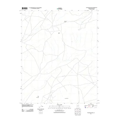
2011 Map of Star Mountain
USGS Topo · Published 2011About this map
Star Mountain and the smaller Little Star Mountain anchor this high-desert landscape in Navajo County, defined by its traditional land routes and natural water sources. The network of roads, including Indian Rte 9757 and Indian Rte 9062, reveals how travel remains tied to the local topography and the scarcity of water. Essential landmarks such as Talahogan Spring and Awatovi Spring are vital points in an otherwise arid region, situated near the dramatic drop-off of Talahogan Canyon. This 2011 survey by the U.S. Geological Survey illustrates a sparsely populated terrain where prominent features like Adams Butte serve as critical navigational markers across the plateau, preserving the contemporary layout of these tribal lands.
Find a feature on this map
8 named features on this map. Tap any name to fly to it.
Don’t see what you’re looking for? This feature index may not catch every label — zoom into the map to look around manually.
Map Details
Editions of this 2011 Star Mountain Map
This is the sole edition of this map. No revisions or reprints were ever made.
Other maps of this area

1883 · Tusayan
USGS Topo · 1:250,000

1886 · Tusayan
USGS Topo · 1:250,000

1947 · Flagstaff
USGS Topo · 1:250,000

1954 · Flagstaff
USGS Topo · 1:250,000

1958 · Flagstaff
USGS Topo · 1:250,000

1960 · Flagstaff
USGS Topo · 1:250,000

1962 · Flagstaff
USGS Topo · 1:250,000

1966 · White Cone
USGS Topo · 1:62,500

1966 · Egloffstein Butte
USGS Topo · 1:62,500
1966 · Keams Canyon
USGS Topo · 1:62,500