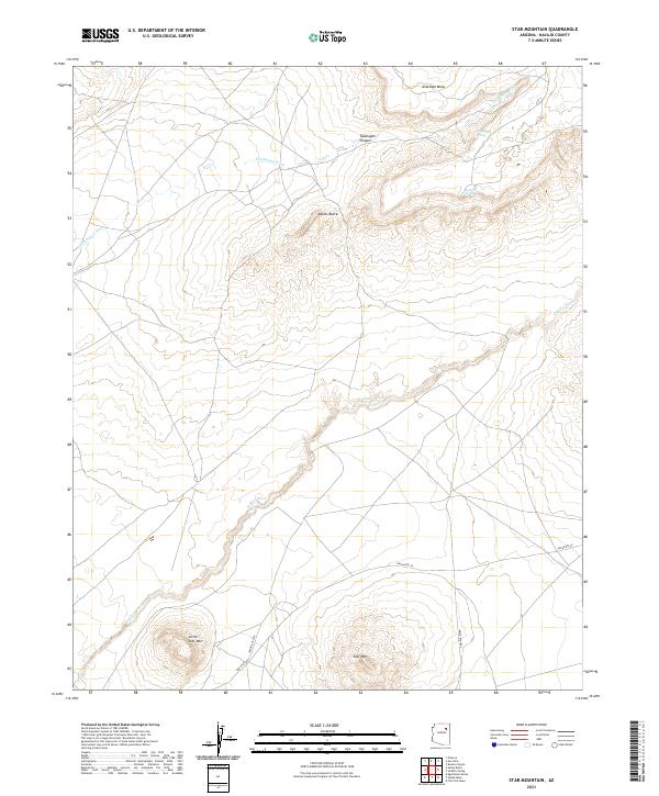
2021 Map of Star Mountain
USGS Topo · Published 2021About this map
Star Mtn and Little Star Mtn anchor the southern reaches of this Navajo County landscape, rising from a high-desert terrain marked by deep washes and volcanic buttes. To the north, the elevation climbs toward Antelope Mesa, where the dramatic incision of Talahogan Canyon cuts through the plateau. Water remains the primary architect of this region, with the expansive Jeddito Wash and Talahogan Wash defining the drainage patterns. These seasonal watercourses are punctuated by essential desert water sources like Awatovi Spring and Talahogan Spring. Modern transit is limited to a network of established routes including Indian Rte 60 and Indian Rte 9757, which follow the natural contours of the land around landmarks like Adams Butte. The map provides a clear look at the township and range survey lines that divide this stretch of the Colorado Plateau into its constituent sections.
Find a feature on this map
17 named features on this map. Tap any name to fly to it.
Don’t see what you’re looking for? This feature index may not catch every label — zoom into the map to look around manually.
Map Details
Editions of this 2021 Star Mountain Map
This is the sole edition of this map. No revisions or reprints were ever made.
Other maps of this area

1883 · Tusayan
USGS Topo · 1:250,000

1886 · Tusayan
USGS Topo · 1:250,000

1947 · Flagstaff
USGS Topo · 1:250,000

1954 · Flagstaff
USGS Topo · 1:250,000

1958 · Flagstaff
USGS Topo · 1:250,000

1960 · Flagstaff
USGS Topo · 1:250,000

1962 · Flagstaff
USGS Topo · 1:250,000

1966 · White Cone
USGS Topo · 1:62,500

1966 · Egloffstein Butte
USGS Topo · 1:62,500
1966 · Keams Canyon
USGS Topo · 1:62,500