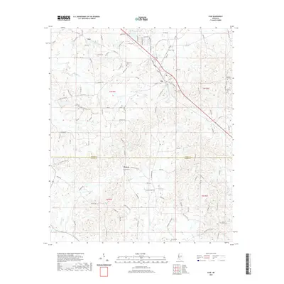
2020 Map of Star
USGS Topo · Published 2020About this map
Star sits as a central crossroads on the border of Rankin Co and Simpson Co, where a network of local routes like Loflin Rd and Andrew Jackson Cir converge. The landscape is defined by its numerous rural burial grounds, including the centrally located Star Cem and the nearby Morning Star Cem, reflecting the deep-rooted community history of the region. To the north, the settlement of Anse is connected by Anse Rd and Green Hill Rd, while the southern reaches of the map feature Rexford and its namesake Rexford Cem.
Find a feature on this map
115 named features on this map. Tap any name to fly to it.
Don’t see what you’re looking for? This feature index may not catch every label — zoom into the map to look around manually.
Map Details
Editions of this 2020 Star Map
This is the sole edition of this map. No revisions or reprints were ever made.
Other maps of this area

1903 · Jackson
USGS Topo · 1:125,000

1906 · Florence
USGS Topo · 1:62,500

1908 · Florence
USGS Topo · 1:62,500

1953 · Hattiesburg
USGS Topo · 1:250,000

1953 · Meridian
USGS Topo · 1:250,000

1953 · Natchez
USGS Topo · 1:250,000

1955 · Jackson
USGS Topo · 1:250,000

1956 · Natchez
USGS Topo · 1:250,000

1957 · Meridian
USGS Topo · 1:250,000

1958 · Hattiesburg
USGS Topo · 1:250,000