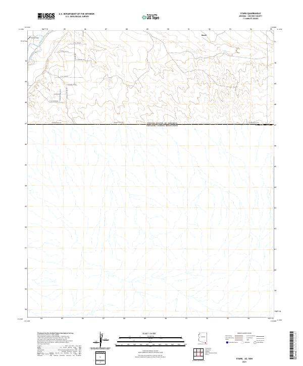
2021 Map of Stark
USGS Topo · Published 2021About this map
Stark and Evelyn Field occupy the northern reaches of this arid Cochise County landscape, where the topography is defined by the ephemeral drainage patterns of the San Pedro River. The map illustrates a contemporary rural grid system dominated by ranching and residential tracks, including S Triple R Ranch Rd and S Rosalita Ranch Rd. Stretching across the center of the sheet is the International Boundary, a line marking the southern limit of U.S. territory. The infrastructure here is sparse, characterized by named access points like E Rachaels Ridge and S Paloma Trl, which navigate the desert terrain north of International Rd. This survey provides a precise modern record of the borderlands just south of the historic mining and ranching hubs of the Arizona territory.
Find a feature on this map
16 named features on this map. Tap any name to fly to it.
Don’t see what you’re looking for? This feature index may not catch every label — zoom into the map to look around manually.
Map Details
Editions of this 2021 Stark Map
This is the sole edition of this map. No revisions or reprints were ever made.
Other maps of this area

1902 · Bisbee
USGS Topo · 1:62,500

1910 · Bisbee
USGS Topo · 1:62,500

1914 · Hereford
USGS Topo · 1:125,000

1916 · Douglas
USGS Topo · 1:125,000

1919 · Douglas
USGS Topo · 1:125,000

1927 · Bisbee
USGS Topo · 1:62,500

1932 · Stark
USGS Topo · 1:62,500
1933 · Bisbee
USGS Topo · 1:62,500
1952 · Hereford
USGS Topo · 1:24,000
1952 · Nicksville
USGS Topo · 1:24,000