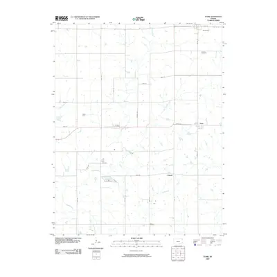
2009 Map of Stark
USGS Topo · Published 2009About this map
Savonburg, Stark, and Kimball anchor this prairie landscape, where the agricultural grid is softened by the winding courses of Canville Creek and its tributaries. The map documents a rural transition where traditional section roads like Rooks Rd and Victory Rd frame vast tracts of farmland and scattered homesteads. Genealogists will find particular value in the clearly marked Savonburg Cemetery, Putnam Cemetery, and Bethel Cemetery, which serve as quiet markers of the generations that settled this portion of Neosho County. The drainage patterns of Little Canville Creek and Fourmile Creek dictate the local topography, while features like Olson Field and the junction at Ksthy 201 highlight the modern infrastructure supporting this long-standing farming community.
Find a feature on this map
32 named features on this map. Tap any name to fly to it.
Don’t see what you’re looking for? This feature index may not catch every label — zoom into the map to look around manually.
Map Details
Editions of this 2009 Stark Map
This is the sole edition of this map. No revisions or reprints were ever made.
Other maps of this area

1886 · Iola
USGS Topo · 1:125,000

1893 · Iola
USGS Topo · 1:125,000

1904 · Iola
USGS Topo · 1:125,000

1947 · Joplin
USGS Topo · 1:250,000

1948 · Erie
USGS Topo · 1:62,500

1949 · Erie
USGS Topo · 1:62,500

1949 · Joplin
USGS Topo · 1:250,000
1951 · Chanute
USGS Topo · 1:62,500

1954 · Joplin
USGS Topo · 1:250,000

1958 · Joplin
USGS Topo · 1:250,000