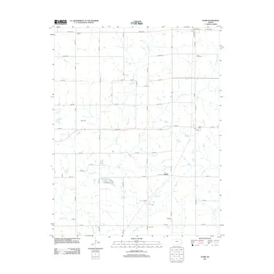
2012 Map of Stark
USGS Topo · Published 2012About this map
Kimball sits near the eastern edge of this Neosho County landscape, a small settlement defined by its proximity to the north-south Railroad and a network of strictly gridded section roads. The terrain is deeply etched by a complex drainage system, most notably Canville Cr and Little Canville Cr, which wind through the prairie to meet Fourmile Cr in the south. These waterways dictated early land use, as seen in the placement of numerous rural burying grounds away from the floodplains.
Find a feature on this map
53 named features on this map. Tap any name to fly to it.
Don’t see what you’re looking for? This feature index may not catch every label — zoom into the map to look around manually.
Map Details
Editions of this 2012 Stark Map
This is the sole edition of this map. No revisions or reprints were ever made.
Other maps of this area

1886 · Iola
USGS Topo · 1:125,000

1893 · Iola
USGS Topo · 1:125,000

1904 · Iola
USGS Topo · 1:125,000

1947 · Joplin
USGS Topo · 1:250,000

1948 · Erie
USGS Topo · 1:62,500

1949 · Erie
USGS Topo · 1:62,500

1949 · Joplin
USGS Topo · 1:250,000
1951 · Chanute
USGS Topo · 1:62,500

1954 · Joplin
USGS Topo · 1:250,000

1958 · Joplin
USGS Topo · 1:250,000