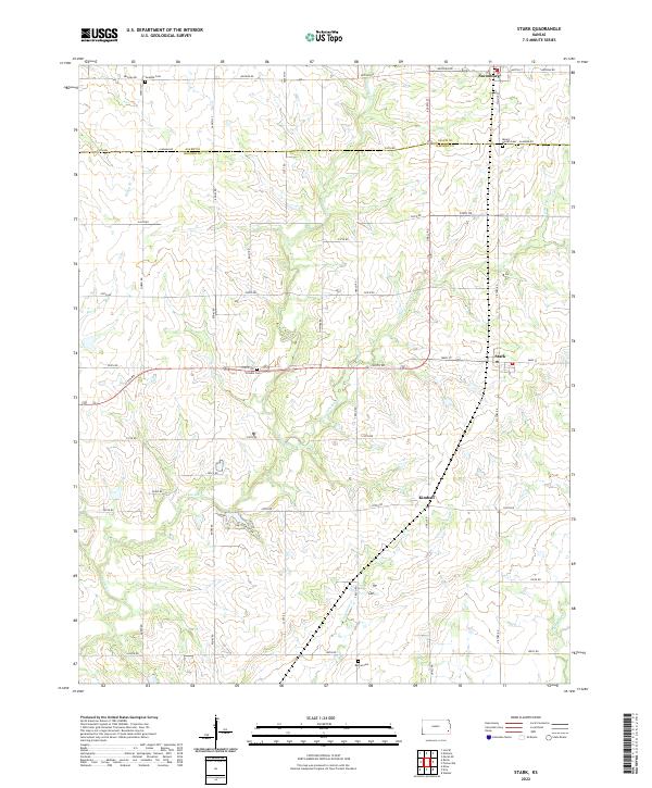
2022 Map of Stark
USGS Topo · Published 2022About this map
Stark and Savonburg anchor the northern and central portions of this agricultural landscape along the Allen and Neosho County line. The terrain is defined by a dense network of waterways, including Canville Creek, Little Canville Creek, and Fourmile Creek, which carve through the section lines of the rural grid. This late-stage survey preserves the locations of several community burial grounds that mark the heritage of the area's early settlers, such as the Swedish Cemetery and Putnam Cemetery. Notable elevation is found at Mount Moriah, which stands near Moriah Cemetery. The small settlement of Kimball serves as a secondary focal point in the southern half, surrounded by a complex system of local roads like Udall Road and Victory Road that follow the established township and range system.
Find a feature on this map
51 named features on this map. Tap any name to fly to it.
Don’t see what you’re looking for? This feature index may not catch every label — zoom into the map to look around manually.
Map Details
Editions of this 2022 Stark Map
This is the sole edition of this map. No revisions or reprints were ever made.
Other maps of this area

1886 · Iola
USGS Topo · 1:125,000

1893 · Iola
USGS Topo · 1:125,000

1904 · Iola
USGS Topo · 1:125,000

1947 · Joplin
USGS Topo · 1:250,000

1948 · Erie
USGS Topo · 1:62,500

1949 · Erie
USGS Topo · 1:62,500

1949 · Joplin
USGS Topo · 1:250,000
1951 · Chanute
USGS Topo · 1:62,500

1954 · Joplin
USGS Topo · 1:250,000

1958 · Joplin
USGS Topo · 1:250,000