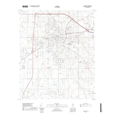
2018 Map of Starkville
USGS Topo · Published 2018About this map
Starkville serves as the central hub of this 2018 survey, reflecting a landscape defined by the intersection of academic, municipal, and rural life in Oktibbeha County. The town core is dense with significant local history markers, including the Associated Reform Presbyterian Cem and the Old Presbyterian Cem, while the expansive campus of Mississippi State dominates the eastern quadrant. Beyond the town's built environment, the terrain is deeply etched by a network of creeks with distinctive regional names, such as Tobacco Juice Cr, Talking Warrior Cr, and Biba Wila Cr. These waterways, along with Sand Cr and Catalpa Cr, outline the natural drainage patterns of the area, while the George M Bryan Airport to the west and the outlying community of Clayton Village to the east highlight the modern infrastructure and expanding residential footprint of the region.
Find a feature on this map
181 named features on this map. Tap any name to fly to it.
Don’t see what you’re looking for? This feature index may not catch every label — zoom into the map to look around manually.
Map Details
Editions of this 2018 Starkville Map
This is the sole edition of this map. No revisions or reprints were ever made.
Other maps of this area

1953 · West Point
USGS Topo · 1:250,000

1958 · West Point
USGS Topo · 1:250,000

1959 · Artesia
USGS Topo · 1:62,500

1959 · West Point
USGS Topo · 1:62,500

1959 · Pheba
USGS Topo · 1:62,500

1963 · West Point
USGS Topo · 1:250,000

1965 · Starkville
USGS Topo · 1:24,000

1965 · Bluff Lake
USGS Topo · 1:24,000

1965 · Longview
USGS Topo · 1:24,000

1965 · Bradley
USGS Topo · 1:24,000