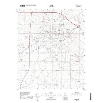
2020 Map of Starkville
USGS Topo · Published 2020About this map
Starkville serves as the focal point of this survey, illustrating the dense street grid and civic center that includes the Oktibbeha County Courthouse and its Courthouse Annex. To the east, the extensive grounds of Mississippi State University dominate the landscape, positioned between the city center and the residential pocket of Clayton Village. This 2020 layout shows the modern transportation infrastructure surrounding the university and the city, including the George M Bryan Airport to the west.
Find a feature on this map
203 named features on this map. Tap any name to fly to it.
Don’t see what you’re looking for? This feature index may not catch every label — zoom into the map to look around manually.
Map Details
Editions of this 2020 Starkville Map
This is the sole edition of this map. No revisions or reprints were ever made.
Other maps of this area

1953 · West Point
USGS Topo · 1:250,000

1958 · West Point
USGS Topo · 1:250,000

1959 · Artesia
USGS Topo · 1:62,500

1959 · West Point
USGS Topo · 1:62,500

1959 · Pheba
USGS Topo · 1:62,500

1963 · West Point
USGS Topo · 1:250,000

1965 · Starkville
USGS Topo · 1:24,000

1965 · Bluff Lake
USGS Topo · 1:24,000

1965 · Longview
USGS Topo · 1:24,000

1965 · Bradley
USGS Topo · 1:24,000