2024 Map of Starkville
USGS Topo · Published 2024About this map
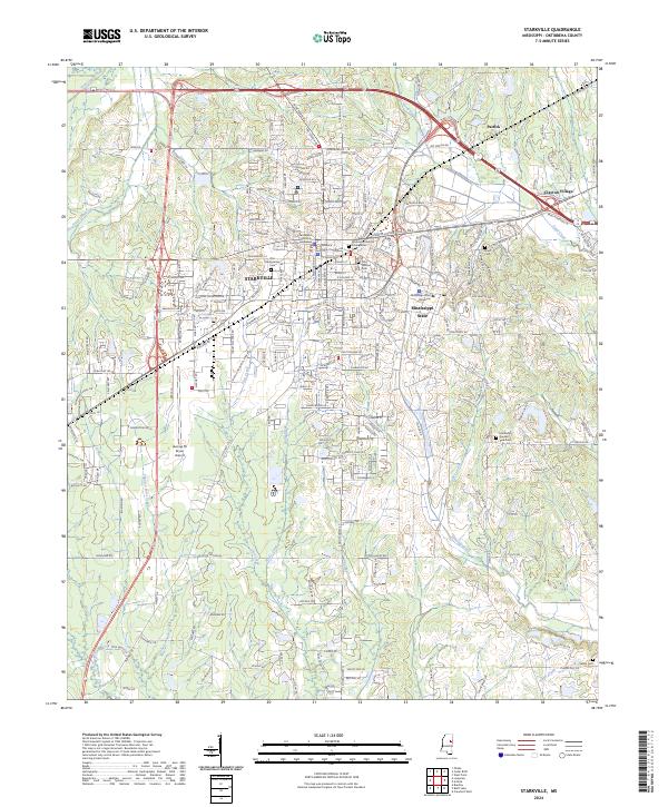
Starkville serves as the focal point of this Oktibbeha County landscape, dominated by the sprawling campus of Mississippi State University. The city's civic center is clearly marked by the Oktibbeha County Courthouse and its annex, while the local aviation hub, George M Bryan Airport, sits to the west. The surrounding terrain is defined by a network of drainage systems including Tobacco Juice Creek, Hollis Creek, and Catalpa Creek, which provide a natural structure to the rural areas surrounding the urban center. Several significant burial grounds, such as the Old Presbyterian Cem, Odd Fellows Cem, and Associated Reform Presbyterian Cem, offer valuable reference points for genealogical research. To the east and north, the small settlements of Clayton Village and Patrick mark the transition from the university environment to the outlying agricultural and wooded lands of the interior.
Find a feature on this map
52 named features on this map. Tap any name to fly to it.
Don’t see what you’re looking for? This feature index may not catch every label — zoom into the map to look around manually.
Map Details
Editions of this 2024 Starkville Map
This is the sole edition of this map. No revisions or reprints were ever made.
Historical Maps of Quail Valley Through Time
Featured Locations
- Starkville, MS
- Country Hills, Starkville
- Parkside, Starkville
- Deerfield, Starkville
- Green Oaks, Starkville