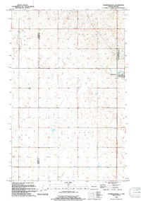
1994 Map of Starkweather
USGS Topo · Published 1994About this map
Starkweather serves as the primary hub of this North Dakota landscape, situated along the eastern edge of the quadrangle. The surrounding prairie is defined by a dense network of seasonal wetlands and prairie potholes, including the prominent Davis Slough in the central township of Hammer. This 1994 revision reflects the persistence of the region's agricultural and conservation character, with the National Waterfowl Production Area occupying land just north of the townsite. Local history is anchored by the Bergen Cem in the southern reaches, providing a key point of reference for genealogists. The map preserves the administrative layout of Klingstrup and Hammer townships, showing the section-line roads and field boundaries that have organized this part of the Devils Lake basin for generations.
Find a feature on this map
7 named features on this map. Tap any name to fly to it.
Don’t see what you’re looking for? This feature index may not catch every label — zoom into the map to look around manually.
Map Details
Editions of this 1994 Starkweather Map
This is the sole edition of this map. No revisions or reprints were ever made.
Other maps of this area

1953 · Devils Lake
USGS Topo · 1:250,000

1956 · Devils Lake
USGS Topo · 1:250,000

1957 · Cando SE
USGS Topo · 1:24,000

1957 · Starkweather SE
USGS Topo · 1:24,000

1957 · Cando NE
USGS Topo · 1:24,000

1957 · Webster
USGS Topo · 1:24,000

1962 · Egeland SE
USGS Topo · 1:24,000

1962 · Starkweather
USGS Topo · 1:24,000

1962 · Starkweather NE
USGS Topo · 1:24,000

1971 · Munich SW
USGS Topo · 1:24,000