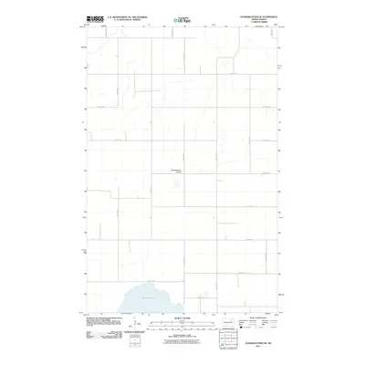
2011 Map of Starkweather SE
USGS Topo · Published 2011About this map
Morrison Lake dominates the southern landscape of this Ramsey County quadrangle, situated in a region defined by its wide, open agricultural plains. The water from Starkweather Coulee feeds into this system, creating a distinct hydrological feature amidst a strictly organized grid of rural roads. This 2011 survey illustrates the precise section-line road network typical of the Red River Valley and Drift Prairie regions, where arterial routes like 83rd Ave NE and 85th Ave NE intersect with east-west connectors such as 58th St NE. The map captures the area before modern shifts in drainage or land use, preserving the exact placement of prairie wetlands and the local infrastructure that supports this remote farming community.
Find a feature on this map
17 named features on this map. Tap any name to fly to it.
Don’t see what you’re looking for? This feature index may not catch every label — zoom into the map to look around manually.
Map Details
Editions of this 2011 Starkweather SE Map
This is the sole edition of this map. No revisions or reprints were ever made.
Other maps of this area

1931 · Devils Lake
USGS Topo · 1:62,500

1950 · Devils Lake
USGS Topo · 1:62,500

1951 · Grand Harbor
USGS Topo · 1:24,000

1951 · Sweetwater
USGS Topo · 1:24,000

1953 · Devils Lake
USGS Topo · 1:250,000

1956 · Devils Lake
USGS Topo · 1:250,000

1957 · Starkweather SE
USGS Topo · 1:24,000

1957 · Webster
USGS Topo · 1:24,000

1962 · Starkweather
USGS Topo · 1:24,000

1962 · Starkweather NE
USGS Topo · 1:24,000