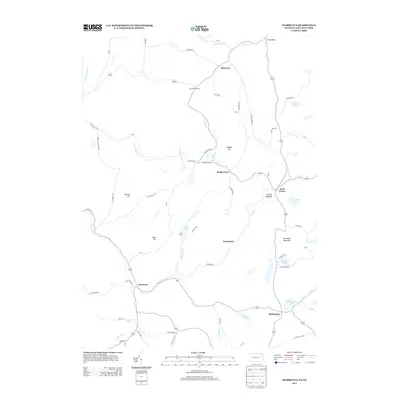
2013 Map of Starrucca
USGS Topo · Published 2013About this map
Starrucca and the surrounding hamlets of the Pennsylvania-New York borderlands are documented here at the start of the 2010s. The landscape is defined by its water and high ground, featuring several notable peaks such as Shrawder Mountain, Slocum Hill, and Maple Hill. These summits overlook a network of glacial lakes and ponds, including Shehawken Lake, Island Lake, and Hiawatha Lake. The settlement pattern follows the drainage of Sherman Cr and Starrucca Cr, with local centers like Scott Center, Maple Grove, and Shehawken linked by a web of rural roads. The area around Bucks Falls and the headwaters of the Merrigan Cr illustrates the character of this interior highland region. This map provides researchers with a record of road names and property locations, from Gardinier Corners to the shores of Mach Pond, during a period of modern rural stability.
Find a feature on this map
71 named features on this map. Tap any name to fly to it.
Don’t see what you’re looking for? This feature index may not catch every label — zoom into the map to look around manually.
Map Details
Editions of this 2013 Starrucca Map
This is the sole edition of this map. No revisions or reprints were ever made.
Other maps of this area

1905 · Nineveh
USGS Topo · 1:62,500

1924 · Starrucca
USGS Topo · 1:48,000

1924 · Deposit
USGS Topo · 1:62,500

1926 · Deposit
USGS Topo · 1:62,500

1926 · Starrucca
USGS Topo · 1:62,500

1930 · Starrucca
USGS Topo · 1:48,000

1932 · Susquehanna
USGS Topo · 1:62,500

1933 · Starrucca
USGS Topo · 1:62,500

1935 · Susquehanna
USGS Topo · 1:62,500

1943 · Honesdale
USGS Topo · 1:125,000