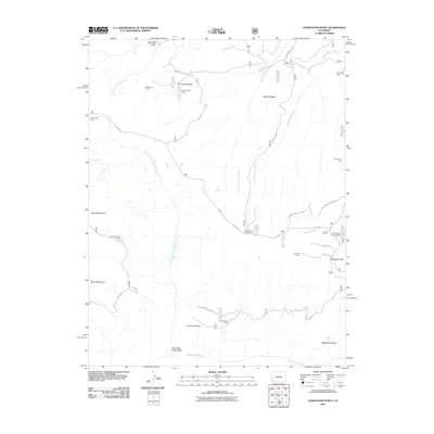
2011 Map of Starvation Point
USGS Topo · Published 2011About this map
Starvation Point and the aptly named The Tongue of Starvation define the stark geography of this Mesa County high-country terrain. The area is marked by a series of distinct cow camps, including Davis, Lockhart, and Porters, which point to a long-standing tradition of seasonal high-altitude ranching. These outposts are connected by a network of specialized routes such as Divide Rd and the Copper King Spur, which leads toward the Copper King Mine at the southern end of Sawmill Mesa. Recreation is represented by the Smokehouse Campground and Columbine Campground, located near Columbine Pass. The landscape is deeply dissected by drainages like East Fork Escalante Creek and North Fork Tabeguache Creek, reflecting the complex watershed of the Tabeguache Basin.
Find a feature on this map
33 named features on this map. Tap any name to fly to it.
Don’t see what you’re looking for? This feature index may not catch every label — zoom into the map to look around manually.
Map Details
Editions of this 2011 Starvation Point Map
This is the sole edition of this map. No revisions or reprints were ever made.
Other maps of this area

1916 · Paradox Valley
USGS Topo · 1:125,000

1922 · Paradox Valley
USGS Topo · 1:125,000

1956 · Moab
USGS Topo · 1:250,000

1959 · Moab
USGS Topo · 1:250,000

1960 · Moab
USGS Topo · 1:250,000
1960 · Nucla
USGS Topo · 1:24,000
1960 · Nucla
USGS Topo · 1:62,500
1960 · Windy Point
USGS Topo · 1:24,000

1962 · Moab
USGS Topo · 1:250,000

1964 · Moab
USGS Topo · 1:250,000